GeoSenseAI® – the platform for monitoring and risk management
GeoSenseAI® brings measurements, weather information and geodata together in one situation overview and supports assessment, alerting and documentation.
One overview instead of scattered data
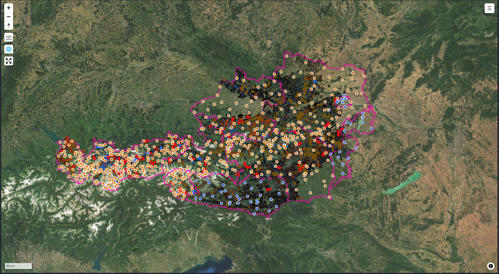
Water levels, vibrations, rainfall and drone imagery come from different sources. GeoSenseAI® brings them together on a map and in time series, showing how the situation is developing.
We agree thresholds with you. When they are exceeded, the platform notifies the right people automatically.
Features
- Map and status
- All monitoring points and catchments with their current status at a glance.
- Time series and trends
- Readings over time, comparison with past events and slow changes such as slope creep.
- Thresholds and alerts
- Configurable alert levels and recipient groups, with real-time notification.
- Hazard zone visualisation
- Flood, debris flow and avalanche zones as a basis for planning and communication.
- Digital twin
- Terrain, buildings and infrastructure in 3D, to estimate who and what an event may affect.
- Event records
- Measurements, imagery and actions documented in full for debriefing, planning and evidence.

Who GeoSenseAI® is for
Municipalities and crisis teams see the situation overview and alert levels. Technical authorities and engineering firms work with time series and geodata. Infrastructure operators keep their routes and assets in view.
The platform runs in any browser on desktop, tablet and smartphone. If required, a traffic-light status can also be published on a municipal website or public displays. [GMD MUSS PRÜFEN: approve public display feature for marketing]
Data storage
Data storage and usage rights are agreed contractually for each project. [GMD MUSS PRÜFEN: add hosting location, certifications, privacy details]
GeoSenseAI® FAQ
What data does GeoSenseAI® process?
Readings from GMD® sensors, weather information and other sources such as geodata or drone imagery. Which external sources are integrated is agreed for each project.
Can GeoSenseAI® work with our existing gauges?
Connecting existing gauges or stations is generally possible and is assessed during the project. [GMD MUSS PRÜFEN: name interfaces/standards]
Which devices does it run on?
GeoSenseAI® runs in the browser on desktop, tablet and smartphone.
How is GeoSenseAI® priced?
As software-as-a-service on a subscription basis, optionally bundled with sensors, operation and maintenance.
Next: sensors and technology and case studies
See GeoSenseAI® in your use case
We'll walk you through the platform using an example that matches your site.